How GIS is revolutionizing progress on the sustainable development goals (SDGs)
The Sustainable Development Goals (SDGs) represent humanity’s most ambitious blueprint for ending poverty, protecting the planet, and ensuring peace and prosperity for all. Yet, as inspiring as this vision is, the path to achieving it is filled with complexities. How can we effectively track progress, uncover hidden challenges, and make informed decisions to move the needle on these global priorities?
The answer lies in Geographic Information Systems (GIS) a transformative technology turning data into action.
The Power of GIS in Driving Global Change
GIS isn’t just a tool for maps it’s a game-changer for sustainable development. By layering spatial data with real-world insights, GIS provides decision makers with a lens to visualize problems, understand patterns, and uncover opportunities like never before.
Imagine mapping poverty hotspots (SDG 1) to target interventions where they’re needed most. Or using GIS to monitor the effects of climate change (SDG 13) in real time, enabling faster and more targeted adaptation strategies. The possibilities are as vast as the challenges we face.
But GIS doesn’t just help us see the world differently it empowers us to act with precision.
Unlocking the SDGs with GIS
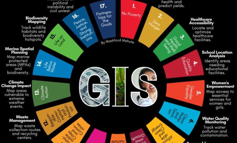
Here’s how GIS is already accelerating progress across the 17 SDGs:
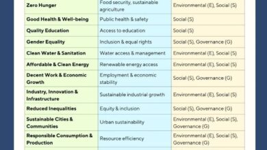
- Ending Poverty (SDG 1): By identifying underserved areas, GIS helps allocate resources and design targeted poverty alleviation programs.
- Zero Hunger (SDG 2): GIS enables smarter agricultural planning by mapping soil quality, water availability, and crop suitability, ensuring food security.
- Good Health and Well-Being (SDG 3): GIS supports pandemic response by tracking disease outbreaks and ensuring equitable access to healthcare.
- Quality Education (SDG 4): It pinpoints educational disparities, guiding investments in schools, teachers, and technology where they’re needed most.
- Clean Water and Sanitation (SDG 6): GIS maps water resources and sanitation infrastructure, helping deliver clean water to underserved regions.
- Climate Action (SDG 13): From mapping deforestation to tracking rising sea levels, GIS informs proactive climate policies and strategies.
Beyond Data: A Call to Action
GIS isn’t just about technology it’s about transforming insights into impact. Governments can use it to craft policies that are fair and data-driven. NGOs can deploy it to amplify their reach and effectiveness. Businesses can harness GIS to align with ESG goals and unlock sustainable innovation.
But here’s the challenge: GIS is only as powerful as the intent behind it. Are we willing to let data guide us, even when it reveals uncomfortable truths? Are we prepared to collaborate across sectors to turn insights into action?
Your Role in the GIS Revolution
Whether you’re a policymaker, an urban planner, a public health advocate, or an environmentalist, GIS can amplify your impact. It’s a tool for solving real-world problems, not just observing them.
So, here’s the question for you: How can GIS help you achieve the SDGs in your field?
Let’s spark a conversation. Share your ideas, add to this list, and inspire others with examples of how GIS is driving meaningful change. Together, we can use this technology to bridge the gap between ambition and action and build a sustainable future that leaves no one behind.
source :
Temukan peta dengan kualitas terbaik untuk gambar peta indonesia lengkap dengan provinsi.