14 Applications of GIS in Water Resources
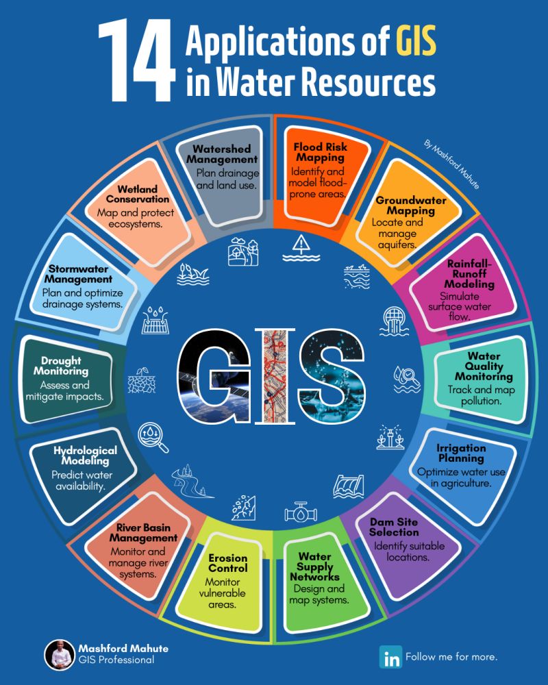
Water is one of our most precious resources, and its sustainable management is critical for the well-being of people, ecosystems, and economies.
Geographic Information Systems (GIS) have become a cornerstone in addressing water-related challenges, offering powerful tools for analysis, planning, and decision-making.
From mitigating flood risks and conserving wetlands to optimizing irrigation and monitoring droughts, GIS enables smarter, data-driven solutions that ensure water resources are used efficiently and responsibly.
With spatial data, we can better understand water dynamics, protect vulnerable areas, and design systems that meet the growing demands of a changing world.
These 14 applications highlight the incredible potential of GIS to revolutionize water management, fostering resilience and sustainability for generations to come.
If you find this post valuable, kindly consider reposting.
Sumber:
Temukan peta dengan kualitas terbaik untuk gambar peta indonesia lengkap dengan provinsi.